

Satellite imagery is used in agriculture, mapping, and environmental monitoring. However, before ordering, it’s useful to check if the image fits your needs. SkyFi allows you to view sample images directly on the platform, which helps with that process. In this tutorial, you will learn how to check sample images on SkyFi, step by step.
SkyFi works in any browser, so you don’t need extra tools or technical skills. As a result, a wide range of users can access satellite data without difficulty. Whether you are working on a project or reviewing image options, the interface keeps the process clear and direct.
First, you will search for a location. Then, you will apply filters and view available previews. These sample images help you check image quality, coverage, and date before ordering. Therefore, you can save time and make more informed choices. Use this guide to begin viewing sample images on the SkyFi platform.
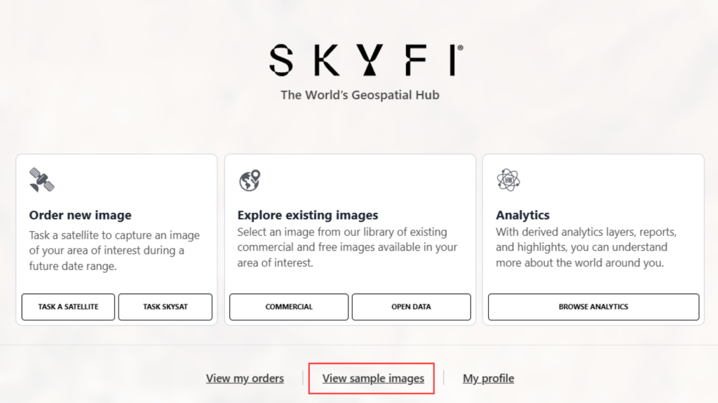
1. Access Sample Images
- Click on “View Sample Images.”
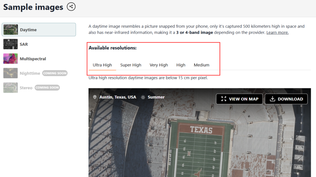
2. Browse Available Resolutions
- Use the resolution toggle to switch between the available image resolutions.
- This allows you to see how different resolutions affect image clarity and detail.
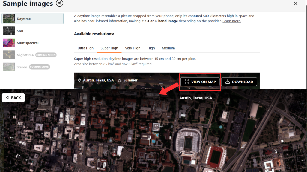
3. Open and View on Map
- Select a sample image and click “View on Map.”
- You can zoom in fully to examine the image in greater detail.
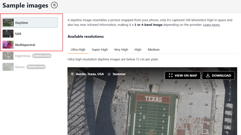
4. Choose Image Type
- You can view sample images from different sensor types, including:
- Daytime
- SAR (Synthetic Aperture Radar)
- Multispectral
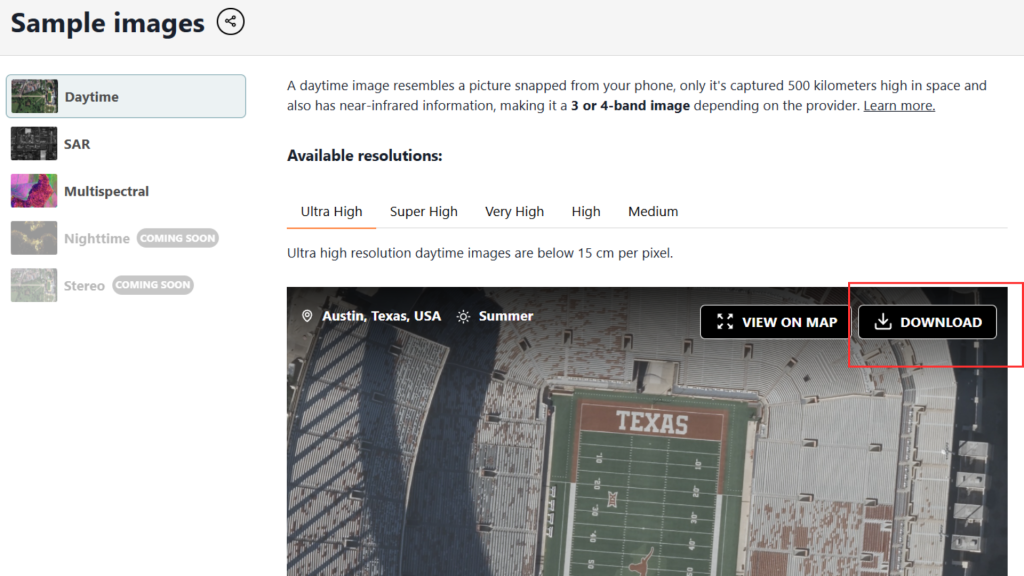
5. Download Sample
- If needed, you can download the sample image directly.
Ready to get started? View sample images on the SkyFi platform today and find the satellite data that fits your needs before placing an order.